
Using satellite technology, you can now map the ancient trans-Saharan trade routes with high precision. Satellite imagery reveals faint pathways, stone alignments, and soil or vegetation changes that indicate old caravan routes. This approach helps identify trading towns, stop points, and route shifts over time, all from a distance. By exploring these images further, you’ll uncover how modern technology sheds light on historical trade networks and their evolution.
Key Takeaways
- Satellite technology enables precise identification of ancient trade pathways through high-resolution imagery and surface anomaly detection.
- Faint, linear markings like stone alignments and soil changes reveal well-used caravan routes across deserts.
- Comparing satellite images over time uncovers route shifts, expansions, or contractions related to climate and political changes.
- Remote sensing guides targeted ground surveys, locating trader stops, wells, and resting points efficiently.
- Overall, satellite mapping transforms traditional archaeology into a data-driven process, revealing the scale and complexity of trans-Saharan trade networks.
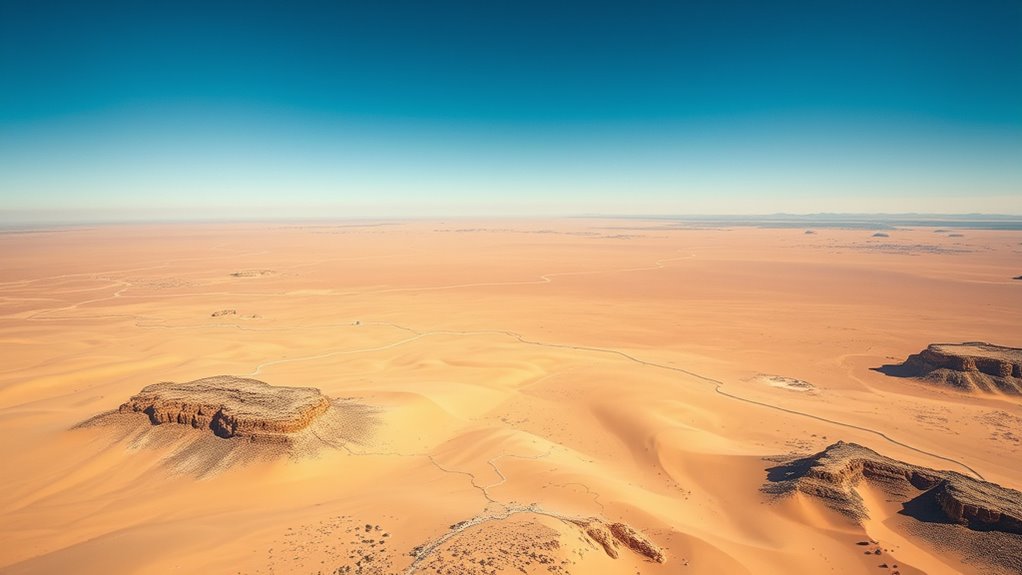
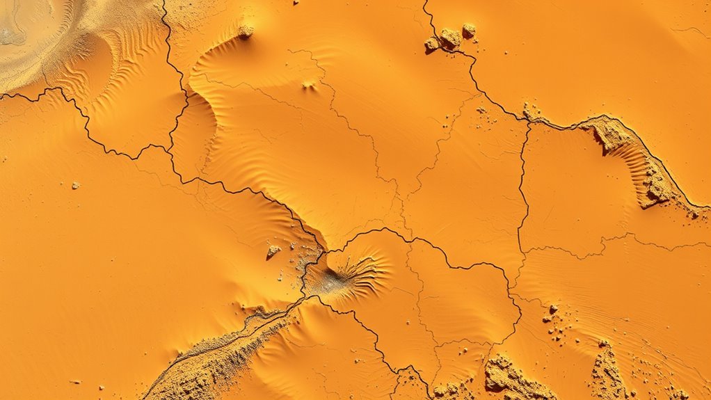
Thanks to advances in satellite technology, researchers can now uncover the hidden pathways of the ancient Trans-Saharan trade routes with unprecedented accuracy. The ability to analyze vast landscapes from space has transformed how we understand the movement of desert caravans, revealing routes that once connected sub-Saharan Africa with North Africa and beyond. These satellite images allow you to identify subtle traces of old trade routes buried beneath layers of sand and vegetation, which are often invisible to the naked eye. By combining satellite data with archaeological survey techniques, you can pinpoint locations where ancient traders likely stopped, traded, and navigated across the harsh desert environment. High-resolution imagery enables you to detect even the faintest signs of ancient pathways, making your analysis more precise and comprehensive.
When you conduct an archaeological survey using satellite imagery, you’re fundamentally piecing together a puzzle that spans centuries. You’ll notice faint, linear markings cutting across the desert landscape—these are the remnants of well-trodden paths used by caravans for generations. These routes, often marked by alignments of stones or subtle changes in soil color, serve as clues to the movement of the desert caravan. The challenge lies in distinguishing these ancient pathways from natural features, but high-resolution satellite images enable you to analyze patterns and anomalies that indicate human activity. This approach allows for a more all-encompassing understanding of the trade network’s reach and complexity.
Thanks to satellite technology, you can now map the entire network of the Trans-Saharan trade routes without the need for extensive ground expeditions. This remote sensing capability accelerates archaeological surveys, allowing you to identify key nodes such as trading towns, wells, and caravan resting points. These sites often appear as faint signatures on satellite images—disrupted soil, unusual vegetation, or man-made structures that have persisted for centuries. Once identified, you can plan targeted ground surveys to verify these sites, saving time and resources. The integration of satellite data with traditional archaeological methods enhances your ability to reconstruct the socio-economic landscape of ancient Sahara traders.
In addition, satellite technology helps you understand how these routes evolved over time, influenced by climate changes, political shifts, and economic demands. You can compare images from different periods to see how routes expanded, contracted, or shifted. This temporal perspective offers insights into how desert caravans adapted to changing conditions, ensuring the survival of trade in one of the world’s harshest environments. Overall, satellite-based mapping transforms your exploration of the Trans-Saharan trade routes from guesswork into a precise, data-driven investigation, opening new windows into the history of desert commerce and connecting you more deeply to this ancient, enduring network.

9502 Satellite Finder, Handy Tool for Quick and Easy Dish Alignment, Sensitive Meter, Illuminated Display
[EASY DISH ALIGNMENT] Align any satellite dish in minutes with this handy tool
As an affiliate, we earn on qualifying purchases.
As an affiliate, we earn on qualifying purchases.
Frequently Asked Questions
How Accurate Are Satellite Images in Identifying Ancient Trade Routes?
You might wonder how accurate satellite images are in identifying ancient trade routes. With digital imaging and terrain analysis, satellites can reveal subtle landscape features like old roads and pathways. While they provide valuable data, some details may be difficult to interpret without ground verification. Overall, satellite imagery offers a high degree of accuracy, helping archaeologists piece together historical routes, but it’s best used alongside other research methods for complete certainty.
What Challenges Do Researchers Face When Interpreting Satellite Data?
When interpreting satellite data, you face challenges like limited image resolution, which can obscure fine details of ancient routes. Data interpretation also requires caution, as natural features or modern developments may be mistaken for historical paths. You need to carefully analyze patterns, compare multiple sources, and understand terrain context to accurately identify and reconstruct these routes. Overcoming these hurdles guarantees more reliable insights into historical trade networks.
Can Satellite Technology Detect Underground or Buried Trade Route Remnants?
You might wonder if satellite technology can detect underground or buried trade route remnants. It’s possible through subsurface detection methods that identify variations in soil and vegetation health. These techniques help with buried artifact identification by revealing subtle changes beneath the surface. While not always perfect, advancements in remote sensing improve your chances of locating hidden features, making satellite data a valuable tool for uncovering ancient trade routes below the ground.
How Do Environmental Changes Affect the Visibility of Ancient Routes From Space?
Environmental changes, like climate shifts and alterations in vegetation patterns, directly impact how visible ancient routes are from space. You’ll notice that droughts may erode surface features or make vegetation less dense, revealing old pathways. Conversely, increased rainfall can cause overgrowth, hiding traces beneath lush growth. These dynamic shifts challenge satellite detection, but understanding these patterns helps you interpret subsurface or buried remnants of ancient trans-Saharan trade routes more accurately.
Are There Any Ongoing Projects Integrating Satellite Data With Archaeological Excavations?
You might be surprised to learn that ongoing projects now integrate satellite archaeology with archaeological excavations through data integration techniques. These initiatives use satellite data to identify potential sites, then verify findings with ground excavations. By combining remote sensing and traditional archaeology, researchers uncover hidden structures and routes more efficiently, revealing ancient trade networks and cultural sites. This synergy enhances our understanding of history, making your exploration of the past more dynamic and precise.

SingularXYZ E1 RTK GNSS Survey Equipment GPS Receiver with IMU Rover & Base Handheld Collector Land Surveying Equipment, Navigation System Survey Software(Include Pole, Tribrach, Tripod)
【15KM (9.32 miles) Radio】E1 GNSS Surveying System supports up to 15KM range in base-rover mode, unaffected by network…
As an affiliate, we earn on qualifying purchases.
As an affiliate, we earn on qualifying purchases.
Conclusion
You’ve uncovered the incredible insight that satellite surveys swiftly showcase the silent, storied routes of the Sahara. By blending bold technology with brilliant archaeology, you bring buried history back to life. This tantalizing tapestry tells tales of trade, travel, and transformation across time. So, seize this satellite’s scope, and stay spirited in your quest to capture the mesmerizing, centuries-old corridors of commerce carved across the scorching sands.

Satellite Remote Sensing for Archaeology
As an affiliate, we earn on qualifying purchases.
As an affiliate, we earn on qualifying purchases.

Ancient Civilizations Map and Timeline Poster (12" x 18")
Explore major ancient civilizations with this educational map and timeline
As an affiliate, we earn on qualifying purchases.
As an affiliate, we earn on qualifying purchases.