TL;DR

Get travel and outdoor gear delivered free — and shop member deals
- Fast, free delivery on millions of items
- Access to Prime Big Deal Days deals on October 6–7
- Prime Video, Amazon Music and more included
Flatten SF is an interactive route tool for comparing paths between San Francisco locations by both distance and cumulative elevation gain. Its creator says calculations run in the browser across more than 160,000 street segments, using USGS lidar elevation and Overture and OpenStreetMap street data.
Drew Edwards has published Flatten SF, an interactive website that helps people find routes between San Francisco locations while comparing how far they travel with how much they climb. The tool processes routes in a browser using a street network of more than 160,000 segments and elevation data, giving users a way to weigh steepness against distance rather than seeing only a single shortest path.
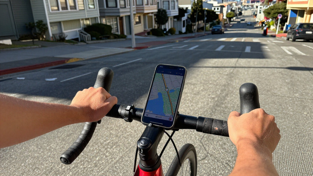
Users enter a starting point and destination, then move a slider across a set of routes that represent different trade-offs between walking distance and cumulative climbing. The site describes these as routes that are not beaten by another option on both measures: a route may be shorter but steeper, or flatter but longer. Moving the slider to the right does not produce a shorter route or add climbing, according to the site.
Flatten SF says its calculations use USGS one-meter lidar elevation data together with street-network data from Overture and OpenStreetMap. Route computation takes place in the user’s browser. The map also shows faint lines for other routes in the range, while its built-in search for San Francisco streets, intersections, addresses and places works offline, the site says.
The route settings reflect how people travel. Stairways are included for walking but excluded for cycling. The site measures climbing as cumulative elevation gain along the route, not simply the difference in elevation between the start and end points. Its explanation says the slider weighs a foot of climbing as equivalent to 200 feet of walking for the flattest route it considers worth taking; routes beyond that point are excluded from the set.
Choosing Between Steepness and Distance
San Francisco’s steep streets can make the shortest path a poor fit for someone trying to avoid hills. By displaying a range of routes instead of presenting distance as the only measure, Flatten SF makes the trade-off visible: users can decide whether a longer journey is worth less climbing, or whether saving distance matters more.
The distinction may be useful for people walking or cycling, including those planning a route around their own comfort or exertion. But the site does not establish that a suggested path is accessible, safe, or suitable for every traveler. Its elevation and street data describe terrain and mapped connections; they do not, by themselves, confirm current construction, surface conditions, street closures, or the accessibility of every stairway and sidewalk.
As an affiliate, we earn on qualifying purchases.
How the Route Data Works
The project combines elevation measurements with a mapped street graph, rather than treating the city as a flat grid. USGS one-meter lidar supplies terrain information, while Overture and OpenStreetMap provide the street-network data named by the site. The calculations are performed locally in the browser, and the page says San Francisco place and address search is built in and functions offline.
Flatten SF’s route choices are defined by two measures: route length and cumulative uphill gain. The interface does not simply label one route “best.” Instead, its slider moves between alternatives that balance those measures, from the shortest path to a flatter option under the site’s stated climb-versus-distance threshold. The site credits Drew Edwards and links to its source, data and full analysis, but the supplied report does not include those materials’ detailed methodology.
“Routes are computed in your browser over 160,000 street segments, using USGS 1 m lidar elevation and the Overture / OpenStreetMap street graph.”
— Flatten SF website
fitness GPS watch with elevation tracking
As an affiliate, we earn on qualifying purchases.
As an affiliate, we earn on qualifying purchases.
Limits of the Published Method
The supplied description does not give a publication date, independent evaluation of route accuracy, or details about how frequently the elevation and street-network data are updated. It also does not explain how the tool handles temporary closures, construction, private paths, sidewalk conditions, or streets whose mapped geometry may not reflect current access. Those details are not confirmed in the source material.
The site’s stated threshold treats one foot of climbing as equivalent to 200 feet of walking when identifying the flattest route it considers worth taking. That is a design choice described by the project, not evidence that every user will judge steepness the same way. The available material also does not establish whether route results have been tested for wheelchair access or other mobility requirements, so users should not treat a flatter route as a guarantee of accessibility.
As an affiliate, we earn on qualifying purchases.
Check Routes Before Setting Out
Flatten SF is available through its website, which also links to the project’s source, data and full analysis. The source material does not announce a release schedule, planned features or a next development milestone. For now, the practical next step for users is to enter a San Francisco origin and destination, compare the distance-and-climbing options, and check the route against current local conditions before traveling.
Because mapped data may not capture a closure or an on-the-ground obstacle, route output should be treated as planning information rather than a real-time street report. People with specific access needs may need to verify individual sidewalks, crossings and stairs through other reliable sources before relying on a suggested path.
cycling computer with elevation data
As an affiliate, we earn on qualifying purchases.
As an affiliate, we earn on qualifying purchases.
Key Questions
What does Flatten SF do?
Flatten SF compares San Francisco routes by distance and cumulative climbing, allowing users to explore alternatives between a shortest route and flatter options.
What data does the tool use?
The website says it combines USGS one-meter lidar elevation data with street-network data from Overture and OpenStreetMap. It says route computations run in the browser across more than 160,000 street segments.
Does it include stairs?
According to the site, stairways are included for walking routes and excluded for bicycle routes. That does not establish whether every mapped stairway is currently open or suitable for a particular traveler.
Does a flatter route mean an accessible route?
No such guarantee is stated in the supplied description. The tool compares distance and climbing, but does not confirm wheelchair access, sidewalk condition, closures or other on-the-ground conditions.
How does Flatten SF measure climbing?
It uses cumulative elevation gain along the route, rather than calculating only the elevation difference between the starting point and destination.
Source: hn
Halloween Picks
halloween
As an affiliate, we earn on qualifying purchases.